 Finalizing data on the Los Naranjos map Okay, you've figured out I’m in Ecuador working on maps for an indigenous tribe. So what’s it all about? - I’ll try to explain, but there’s no book on the subject and I’m learning as I go. Sometime the1960s the Ecuadorian government ceded over several parcels of land to the indigenous Tsáchila tribe who were holding on desperately to the little land remaining from the explosion of development in the area around them. 30 years before, the Tsáchilas lived deep in the forests, hunters of small game - dressed in striped skirts, bare chested and adorned with seed necklaces. Gumercindo Aguavil the current Tsáchila governor recounted to me the tale of his father-in-law who took a stand against mestizo encroachers. After decades of receding further into the forests, they came to a point where there was nowhere else to go. They found themselves surrounded by farms, ranches and small towns. The loss of land meant the loss of habitat for the small game they hunted for food. Pollution of rivers and over fishing left them with no options. Meeting at a river crossing and armed with only machetes and a few arms Gumercindo’s father- in-law announced that they would flee no more and that their land would only be taken upon blood being spilled. The band of mestizos backed down and agreed on the boundary. This area is now known as Congoma, one of the 8 Tsáchila communities. The official acknowledgment from the government and the “gifting” of land in the 60s served more as a politically correct “statement” with no enforced regulations. The land continued to shrink from encroachers and illegitimate land sales. One community has completely been lost. Once nomadic hunters and gatherers, the Tsáchilas were forced into adapting to the changes by becoming farmers. With no education past elementary school and no traditional ties to agriculture their farming practices are ineffective and haphazard. The Santo Domingo area is semi-tropical and has highly productive land… that is for farmers with training and modern techniques. There is a stark difference in the yield per hectare between the mestizo and Tsáchila farmers, with the Tsáchilas harvesting far less. Compounding the problem is that the land given to them was never evenly distributed amongst the people. Some individuals cultivate 30 hectares whereas most families live off of a couple hectares. The parents divide and pass on their land to their children, creating fractured and noncontiguous parcels of land further reducing the cultivation potential. Low crop yield and small amounts of land result in the families not being able to earn enough to support themselves much less dig themselves out of the poverty they are born into. Out of necessity many Tsáchilas have left their homes and culture to find other opportunities in nearby towns. So how does a GIS mapping project fit into the picture? Governor Aguavil has seen the many changes and degradation thru the past 3 decades: the worsening standard of living of his people and especially the loss in cultural pride, heritage and language. He has been working to create a “Plan de Vida” which identifies each of the existing and impending problems and the corresponding proposals to fix the issues. He contracted a company called Tapirus to make cadastral maps of the 7 remaining communities. The maps include roads, rivers, structures, public spaces, and most importantly property boundaries of land owners. I was fortunate enough to get networked with Tapirus in my final 2 weeks in Ecuador. For 2 weeks I digitized all of these features for the community of Los Naranjos. The following week the Tsáchila government administration presented these maps in conjunction with the Plan de Vida to the Ecuadorian Ministry of Development. The maps are the quantitative representation of the dire need of the Tsáchilas. Each map included a list of land owners and the area of land in their possession. The statistic breakdown revealed that 80% of the Tsáchila people live on less than 1 hectare. The intent of this presentation is 1) to make aware the public officials and 2) petition for money for the implementation of initiatives in the Plan de Vida. Tsara Ma Joe - Tenga un buen dia - Have a nice day
 Meet the Aguavil family, my friendly and welcoming Tsa’chila hosts! In the introductory phase of the project I agreed to help out with another project to help build “huertos” or vegetable gardens in the community of Los Naranjos. I lived for a week in the Cultural Community Center in a “choza” (palm thatched hut). The first night there, fortunately for me, other tourists showed up. Fortunate why? -- The Tsa’chilas have adopted many modern ways of living and therefore, do not practice all or many of their traditional cultural customs. So when tourists show up, achiote is applied to the men’s hair, all wear traditional dress and adorn their bodies with temporary tattoos derived from a local plant. We got a little taste of the old days: food cooked in leaves, music and dancing and explanations of the origins of some customs.        Alejandro my host father is a shawman, as were his father and grandfather. For special ceremonies and as a spiritual healing treatment he prepares “ayahuasca”. After boiling the wood of this plant for over an hour, we all huddled in his yurt where he performed the ceremony involving chanting, spitting of liquid (not sure what it was) on ancient rocks and wood carvings, waving of palm fronds and finally the drinking of the hot beverage. Ayahuasca can have severe effects on some people such as hallucinations, fever and vomiting. The 3 tourists who drank the bitter drink (in their words “foul”) only had slight headaches and uncomfortable sleep. Apparently they had positive and clear auras. I opted out… for many reasons, but used the one that I had work the following day.
Standing in the jetway felt like standing on a gangplank. My stomach kept lurching and I had the fleeting thought to bolt backward out the door. “What am I doing?…I’ve done this before and was a complete failure at acquiring a language or adjusting to a new culture.”
--- But there I was. Getting on the same plane, heading to the same place where undoubtedly, I’d face the same struggles as before. I planted my feet, looked ahead, and moved forward with the other passengers onto the plane. Only a month ago did I find the GIS/GPS Internship announcement. Within 2 days of applying, I had interviewed and secured a job with Yanapuma Foundation in Ecuador to map the territory boundaries of an indigenous tribe living in the forests of Ecuador. Without any hesitation I accepted the position and notified my current boss of my near departure in 2 weeks. -- It was time. Hawaii had had its amazing moments, but I felt constrained by the space and opportunities there. After spending a year working on a grad certificate in GIS, in the hopes of breaking into the conservation or land management field, I was struggling to make the right network connections to get entry-level experience. My working background is teaching. For the last 6 years I have taught English as a Second Language and although teaching international students has been rewarding and been a challenge, I have known for awhile that my passion was elsewhere. An opportunity to help an underrepresented ethnic group with a sustainable development project was irresistible and I bit the line. Where it will take me I don’t know, but I will definitely learn how to be resourceful and to collaborate on a project where language and culture may be the biggest obstacles to overcome. I confided in my sister of my doubts and fear of failure on the project. She asked me “What’s the worst that could happen?” Hrmm. Well, I could plot all of the data points incorrectly and create bogus maps. Lose my non-paying job and travel around South America for awhile. Ah, not so bad. Keep it in perspective! So 2 weeks of Spanish classes to refresh the rusty bits and patch up the gaping holes. Then a bus will plummet out of Quito, through the treacherous mountain pass and down to Santo Domingo. There I will be introduced to the Tsa’chila community, whom I will live with for the next 3 months, and will begin the data collection for my first ever mapping project (outside of an academic setting). Still on the plane. One more hour to Quito. One more hour to suspend reality.  On our biking trip to Kaena Point, the western most point on Oahu, we ran into some beaches that weren't well maintained and were trash littered. This made us resolve to come back someday soon to do a beach cleanup. Thankfully, I got a notification from Friends of Kaena of a worldwide cleanup day on Sep 15.2012. We quickly signed up and were soon back out to the beaches armed with gloves and buckets. Dirty Diaper on the Beach.....Yuck!!!
O'opu alamo'o  On a trip to the Big Island in March, I discovered the the odd behavioral adaptaion of the O'opu fish. These critters climb up the rock face of waterfalls (such as Akaka Falls on the left) using suction cup fins in order to reach their spawning grounds. Akaka Falls plunges 442 ft. straight down!! O'opu are endemic to Hawaii and several species live in the streams throughout the Hawaiian Islands. However, critical habitat loss has caused a steady decline in population size over the years. 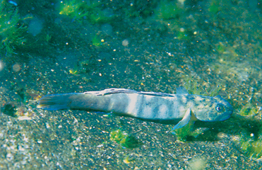 We are in a geospatial revolution - woohoo!!Geospatial technology makes our urban lives a little less hectic ... the bus tracking system mentioned in the video is similar to what the City of Honolulu provides. If only I had a smart phone! Hurrah to all you fellow public transit riders! :) Check out the video below! Today we spent the majority of time weeding in the middle portion of the site area. I hadn't been there in almost a year and was struck by how much the weeds (papyrus, ginger, and grasses) had nearly overgrown the area. A troop of about 40 volunteers broke into 2 groups and began tackling the unruly invaders. The area had been replanted with several natives including uki uki (lilly), mamaki and ava.
 Ed and I headed north to join Friends of Kaena on July 4th. After beachcombing for trash, we lugged tons 5 gallon water jugs from the park entrace to the dune restoration site (in a pickup of course!).
|


